Hydrography
Hydrography
Hydrography is the description of physical features of the ocean, and is the starting point for any analysis of water circulation and the understanding of life within the ocean.
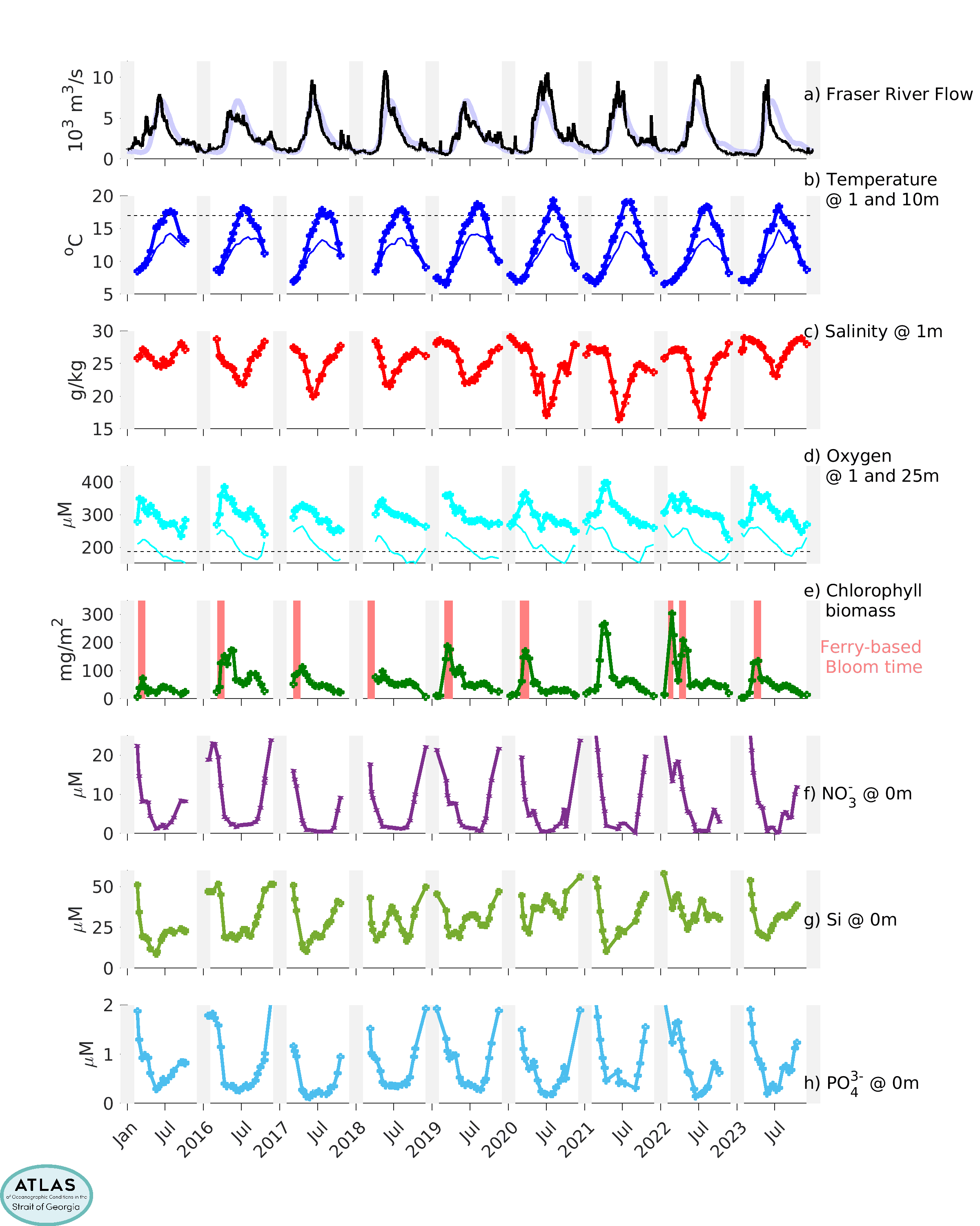
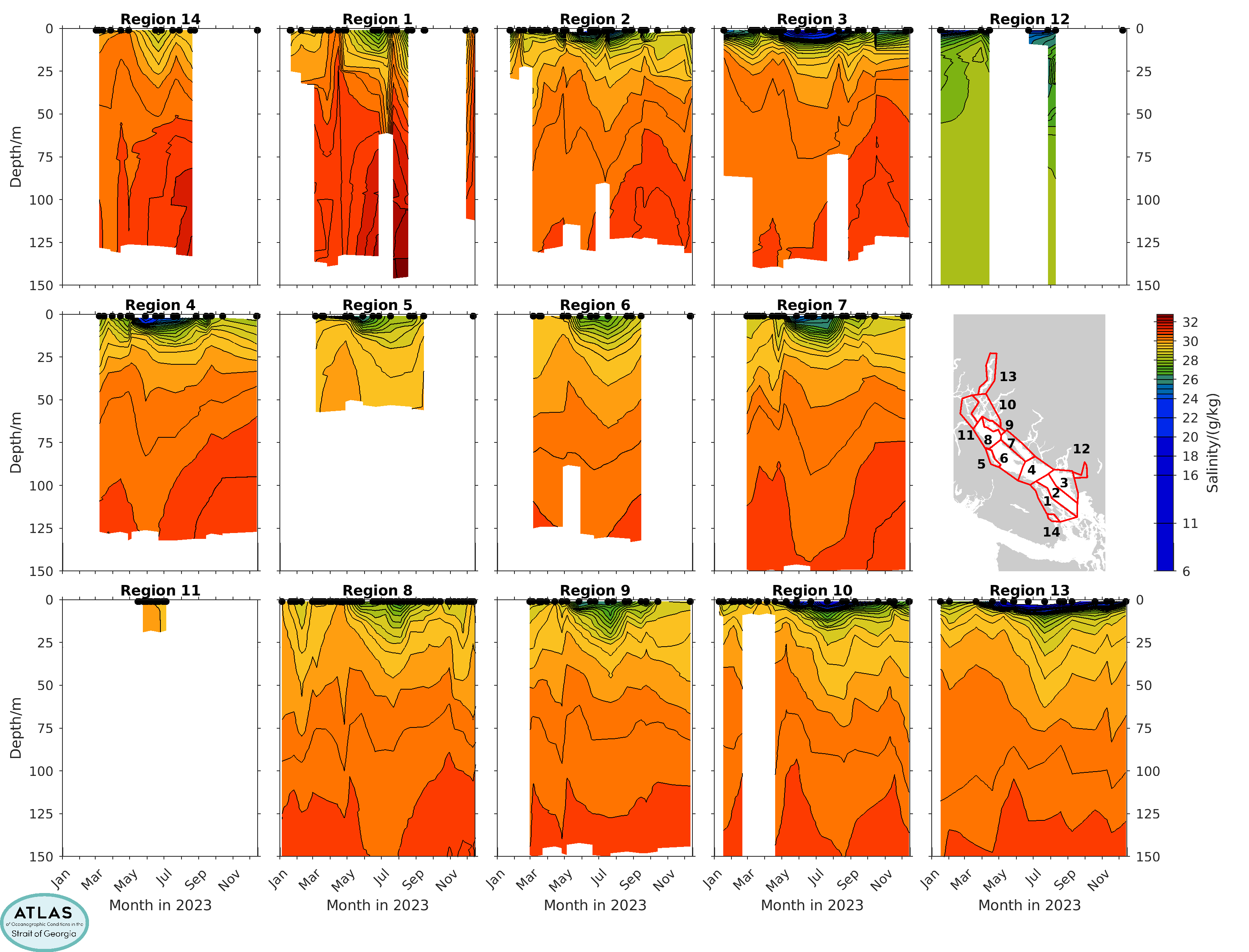
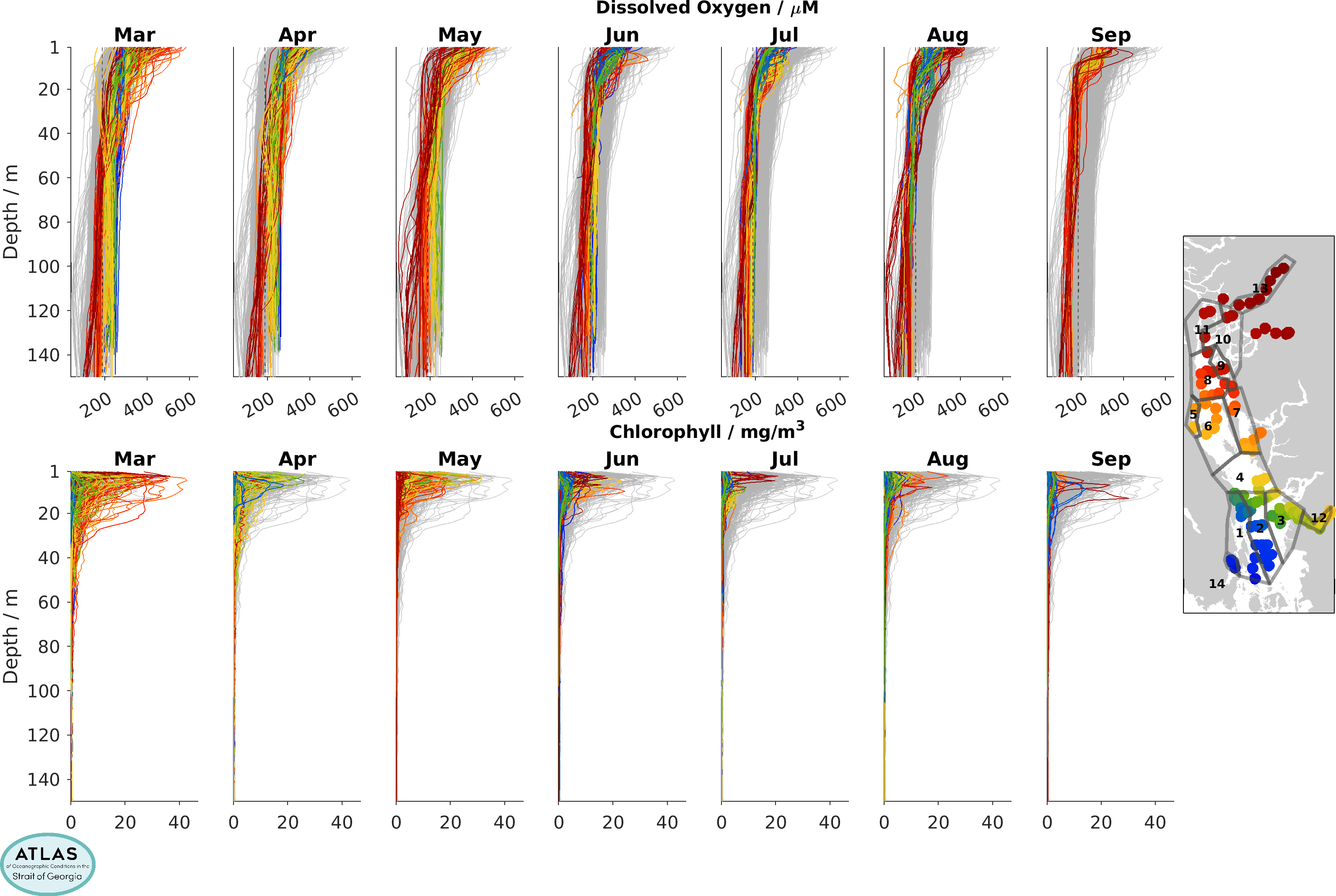
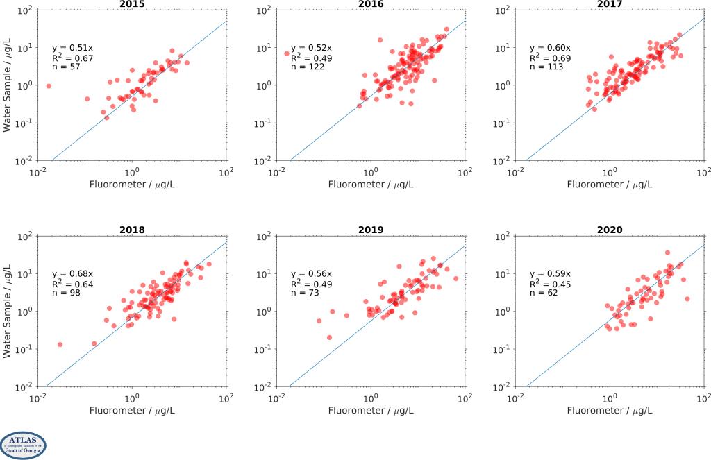
Standard hydrographic properties in the ocean include water temperature, salinity, the dissolved oxygen content, total chlorophyll (as a proxy for the total amount of microscopic plant life, or phytoplankton, that grows in the upper 30m or so of the water column where light can penetrate), and water clarity, which affects the depth to which light penetrates.
Most of these properties, from the surface down to 150m, are measured in the CitSci program by an electronic probe lowered from a boat. Water clarity is measured be separately estimating the Secchi depth.
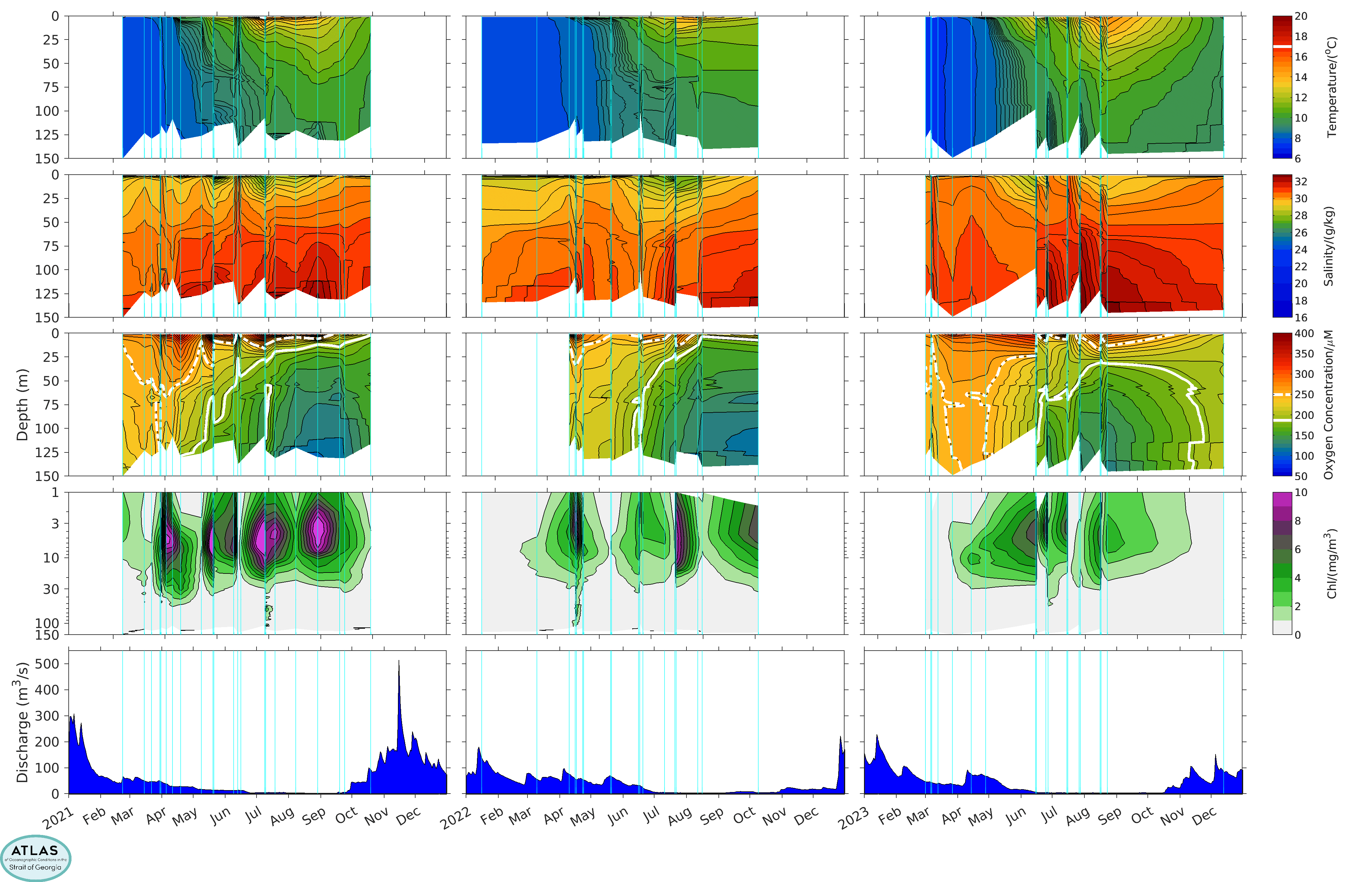
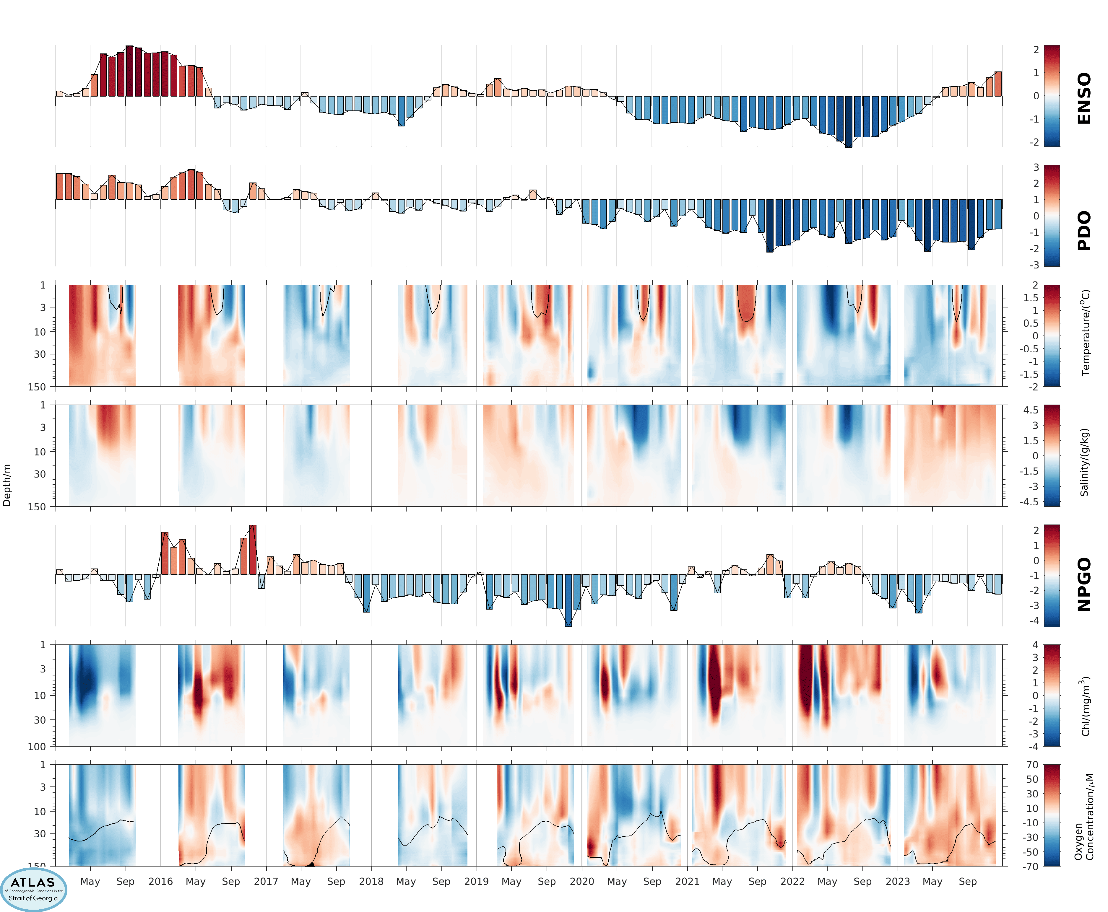
The largest changes in the Strait of Georgia are seasonal, but over longer periods, there are noticeable changes from year to year as well in response to larger climatic variations such as El Nino cycles. The seasonal cycle will provide some background for the changes from year to year, and so sometimes we want to consider the ANOMALIES relative to this mean seasonal cycle.
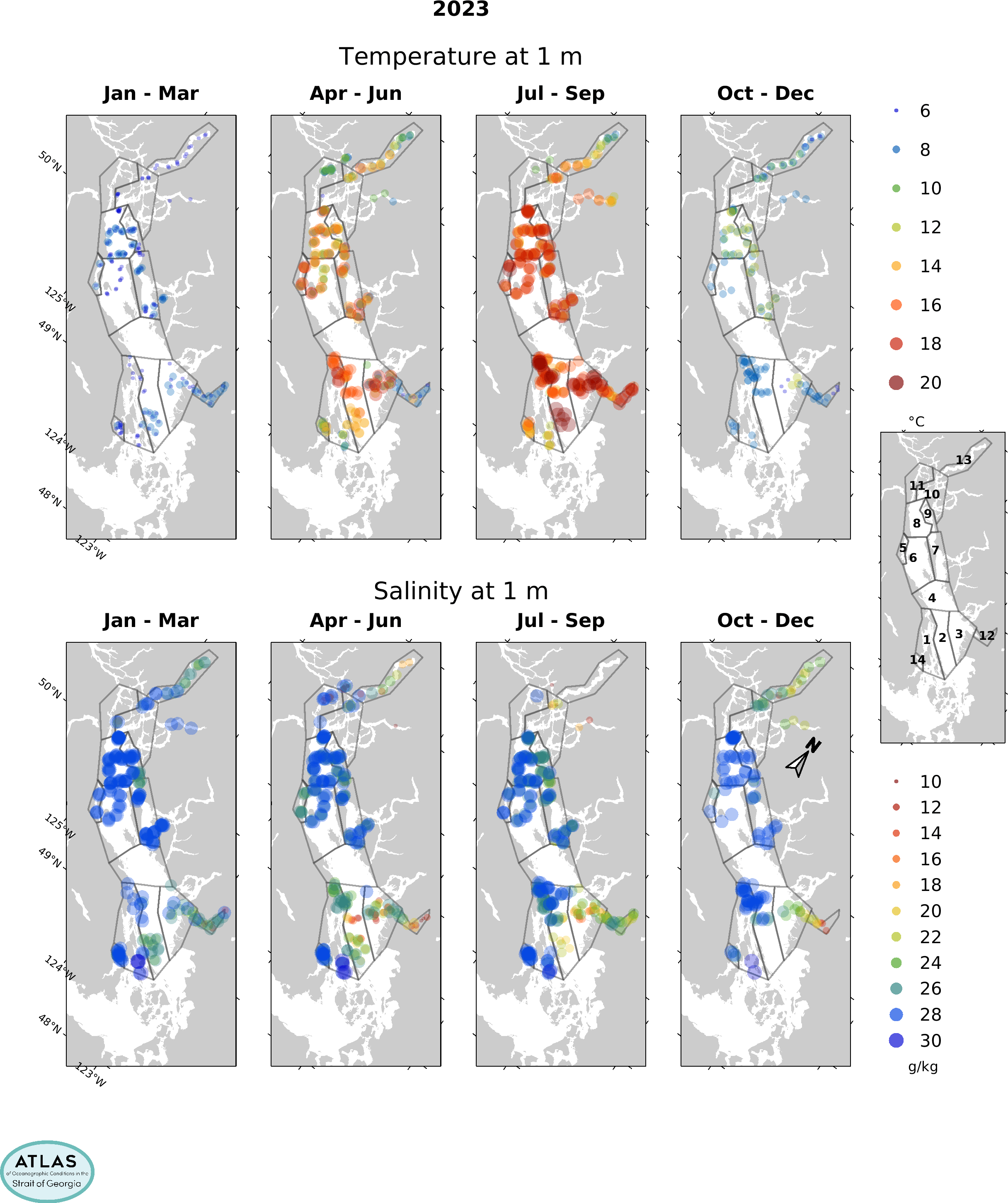
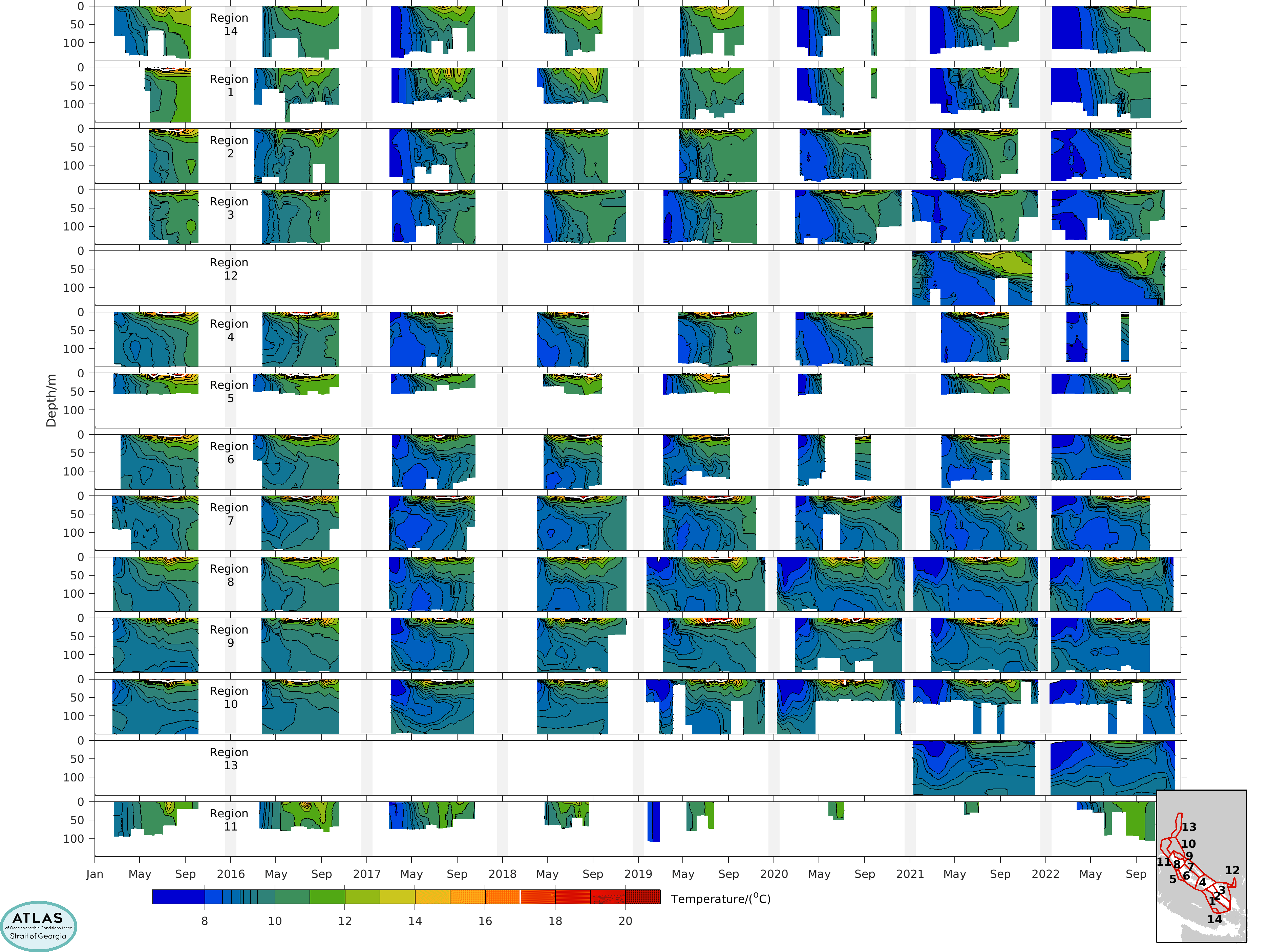
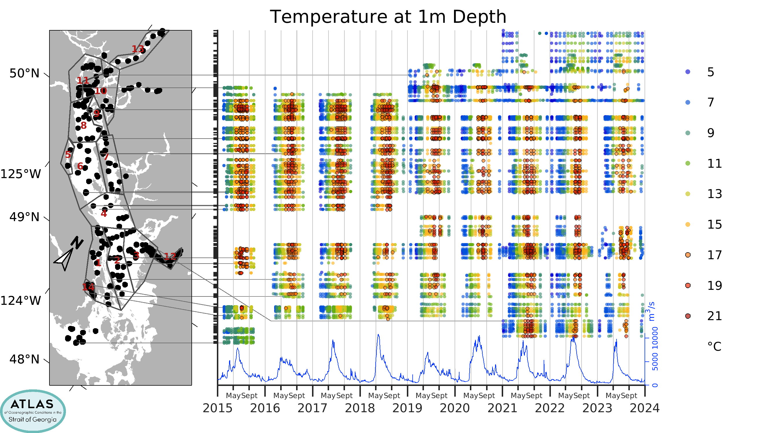
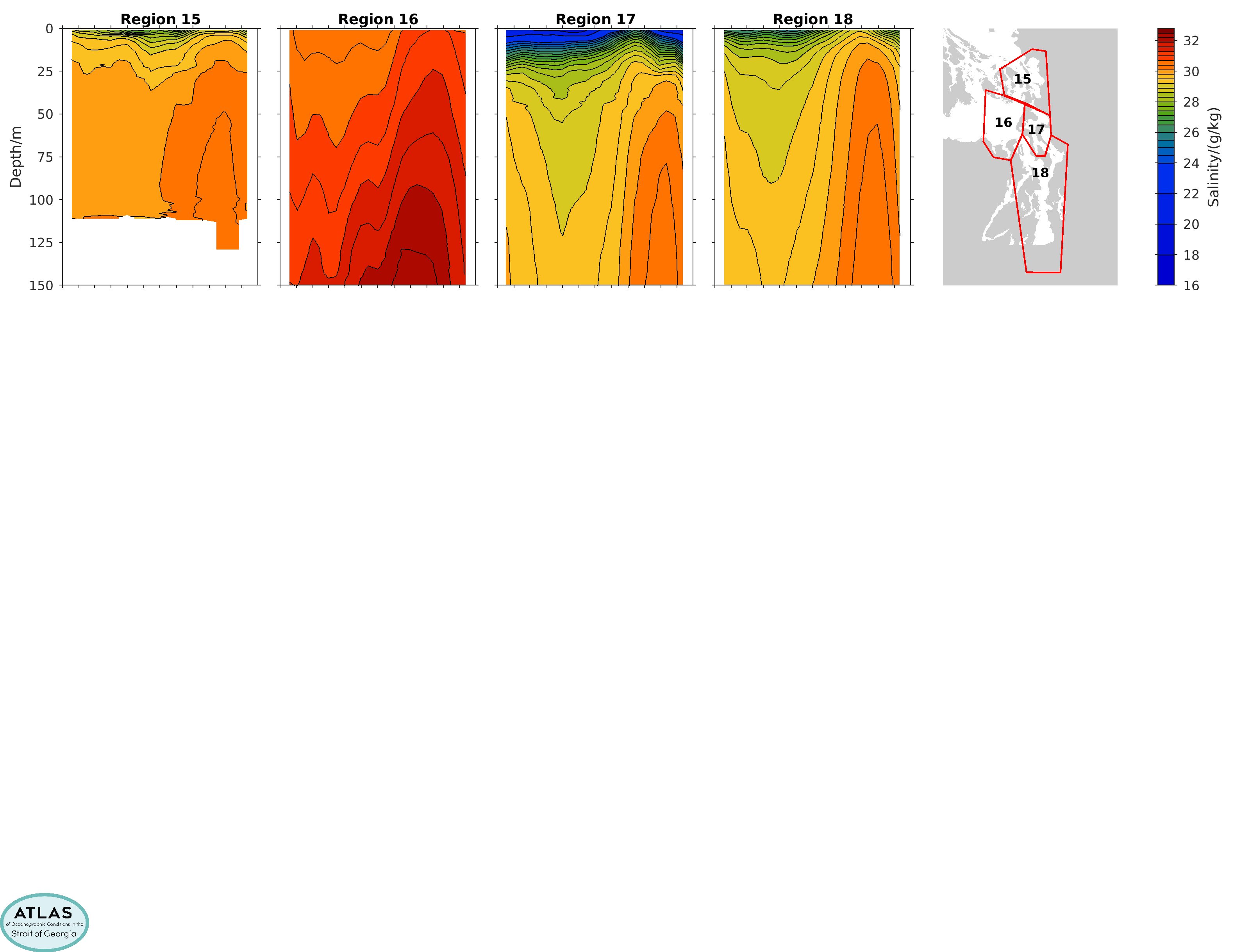
There are also regional differences. In order to show these, we have divided the Strait into 14 areas, and also provide averages in each of those areas.
Environmental Limits
The amount of dissolved oxygen in the water is a particularly important parameter for fish. Although a hypoxic limit of about 2 ppm of O2 (a concentration of about 63 μM) indicates conditions that can lead to death (and this is rarely found in the Strait of Georgia), the growth of actively swimming fish can be adversely affected at concentrations much higher than this hypoxic limit. In fact, approved BC Water Quality Guidelines suggest that an instantaneous threshold of about 5 ppm is required to prevent harm to all life stages of aquatic life, and a 30-day mean of no less than 8 ppm (around 250 μM) is recommended. In our plots, we show a limit of 6 ppm as conservative estimate of the instantaneous threshold (solid white line), and the 8 ppm limit as an estimate of this longer-term mean limit (dash-dotted white line). Staying in waters above these limits often means fish are restricted to quite shallow waters, especially in the late summer.
However, warm temperatures can also affect fish, and the optimal range for salmon and other fish at different life stages are generally under about 17°C (see also here). This limit (in the upper few meters of the Strait's waters in summertime) is also indicated with a solid white line in temperature plots.
Although the Strait is large and deep, you may be surprised at how small a region is really ideal for fish, especially later in the summer.


